Hessen

2,754 rutas en Hessen. Encuentra tu próximo recorrido en Isomaps — mapas topo, GPS y perfil de altitud.

Lahn-Dill-Bergland-Pfad Etappe 1A Dillenburg - Bicken

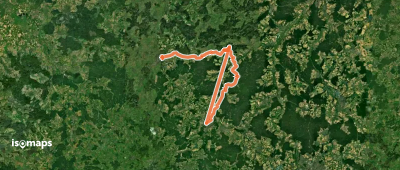
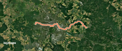
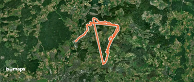
Mittenaar, Allemagne

16,29 km +657 m 4h 50min

Moderado
Knotenweg
Knotenweg

Alsfeld, Allemagne

38,02 km +1 145 m 8h 35min

Muy difícil
Rundweg Silberklippe

Neuerode, Allemagne

4,83 km +211 m 1h 20min

Muy fácil
Nationalparkrundweg Hagenstein-Route

Kirchlotheim, Allemagne

6,07 km +555 m 2h 20min

Moderado
OSM Route 19370611
OSM Route 19370611

Waldems, Allemagne

1,68 km +166 m 30min

Muy fácil
Herkulesweg - Etappe 6

Wilhelmshöhe, Allemagne

23,48 km +565 m 5h 20min

Difícil
Lahn-Dill-Bergland-Pfad Etappe 3 Bad Endbach - Gladenbach

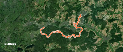
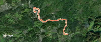
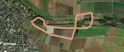
Bad Endbach, Allemagne

17,76 km +720 m 4h 40min

Moderado
Gieseler Forst Süd 3

Giesel, Allemagne

8,54 km +229 m 1h 55min

Fácil
Wanderwege Vogeltal - Eichenblatt

Friedrichsthal, Allemagne

8,00 km +311 m 2h 5min

Fácil
Heilklimaweg 3 Rotes Kreuz

Kleiner Feldberg, Allemagne

5,91 km +205 m 1h 30min

Muy fácil
Gruendchentour (yellow)

Auerberg, Allemagne

19,15 km +486 m 4h 15min

Moderado
Rheinsteig-Zuweg Lorchhausen

Bacharach, Allemagne

1,75 km +148 m 45min

Muy fácil
Schlüchtern Wanderweg SLÜ4

Schlüchtern, Allemagne

9,71 km +272 m 2h 25min

Fácil
Waldeck W9
Waldeck W9

Waldeck, Allemagne

8,12 km +458 m 3h 10min

Moderado
Goller Erlebnispfad Altes Neckarbett

Goddelau, Allemagne

3,30 km +17 m 40min

Muy fácil
Im Wisper Outback
Im Wisper Outback

Wisper, Allemagne

13,21 km +619 m 4h 0min

Moderado
Nordschleife
Nordschleife

Lollar, Allemagne

22,29 km +703 m 5h 0min

Difícil
Herkulesweg - Etappe 5

Wilhelmshöhe, Allemagne

23,23 km +901 m 6h 0min

Difícil
Gieseler Forst Süd 4

Giesel, Allemagne

8,36 km +226 m 1h 55min

Fácil
Wanderwege Vogeltal - Schnepfe

Ziegenberg, Allemagne

2,15 km +85 m 30min

Muy fácil

¿Listo para tu próxima salida?

Prueba Iso Maps gratis 7 días. Disponible en iOS y Android.

Descargar en iOS Descargar en Android APK (sin Google)