90 Touren in Chablais. Finden Sie Ihre nächste Route auf Isomaps — Topokarten, GPS und Höhenprofil.
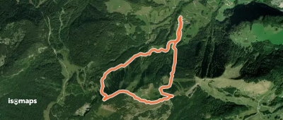
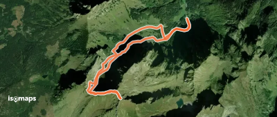
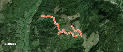
Pointe de la Croix, France
5,96 km +729 m 2h 15min
Mittel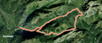
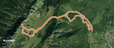
Mont Chauffé, France
18,84 km +1 436 m 5h 0min
Einfach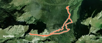
Roc de Tavaneuse, France
7,39 km +1 018 m 3h 0min
Einfach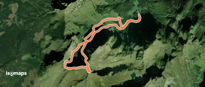
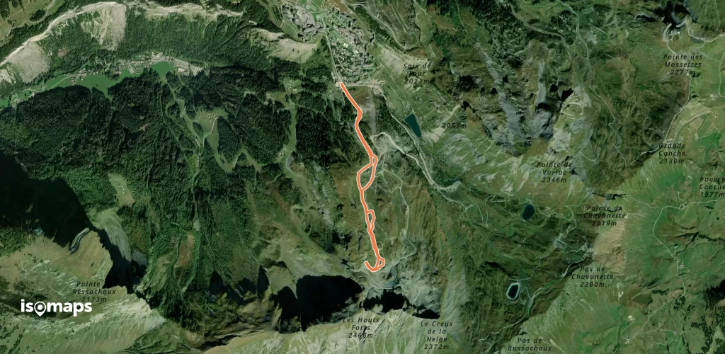

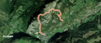
Le Chateau d'Oche, France
5,41 km +725 m 2h 0min
Sehr schwer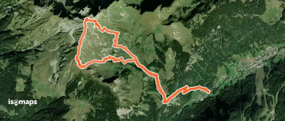
Les Rebelas, France
3,87 km +556 m 1h 35min
Mittel
Col de la Ramaz, France
5,73 km +837 m 2h 20min
Einfach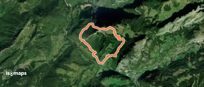
Testen Sie Isomaps 7 Tage kostenlos. Verfügbar für iOS und Android.
