28 Touren in Haute Ariège - Andorre. Finden Sie Ihre nächste Route auf Isomaps — Topokarten, GPS und Höhenprofil.

Pic de Malcaras, France
11,69 km +1 321 m 3h 45min
Einfach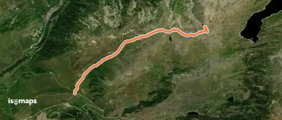
Puig de Trespunts, France
7,15 km +975 m 2h 55min
Mittel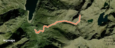
Pic de Malcaras, France
3,66 km +1 223 m 2h 55min
Mittel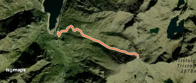
Pic de Malcaras, France
5,50 km +1 256 m 35min
EinfachTesten Sie Isomaps 7 Tage kostenlos. Verfügbar für iOS und Android.
