69 Touren in Valais E - Alpes Pennines E. Finden Sie Ihre nächste Route auf Isomaps — Topokarten, GPS und Höhenprofil.
Feejoch, Switzerland
2,31 km +600 m 1h 35min
Einfach
Weissmies, Switzerland
2,50 km +900 m 30min
Mittel
Dunantspitze, Switzerland
45,00 km +6 246 m 8h 55min
Mittel
Jegiturm, Switzerland
7,00 km +1 085 m 2h 35min
Mittel
Ochsehorn, Switzerland
28,73 km +1 400 m 7h 10min
Mittel
Gabelhornpass, Switzerland
10,00 km +2 000 m 1h 40min
Mittel
Unter Sattla, Switzerland
1,53 km +200 m 25min
Mittel
Rimpfischsattel, Switzerland
16,81 km +1 620 m 5h 20min
Mittel
Stalblatte, Switzerland
1,82 km +300 m 25min
Mittel
Sankt Niklaus, Switzerland
2,93 km +50 m 45min
Mittel
Saas-Balen, Switzerland
1,67 km +500 m 25min
Mittel
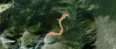
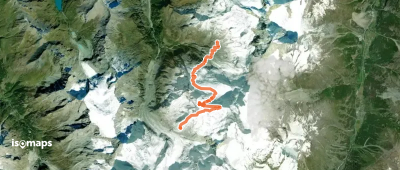
Glacier du Weisshorn, Switzerland
11,28 km +1 100 m 3h 55min
EinfachTesten Sie Iso Maps 7 Tage kostenlos. Verfügbar für iOS und Android.