12 Touren in Valais W - Alpes Pennines W. Finden Sie Ihre nächste Route auf Isomaps — Topokarten, GPS und Höhenprofil.
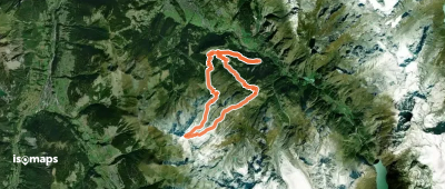
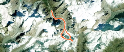
Tsijiore Nouve, Switzerland
18,06 km +1 724 m 5h 20min
Sehr schwer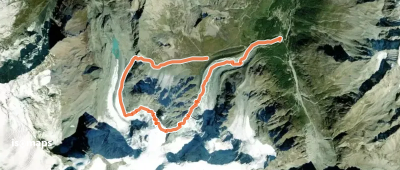
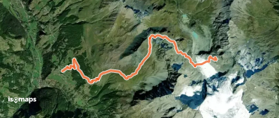
Tunel Gd. St. Bernard, Switzerland
18,20 km +1 285 m 4h 20min
Einfach
Testen Sie Isomaps 7 Tage kostenlos. Verfügbar für iOS und Android.
