Launch offer: subscribe before July 12 and lock in your price for life. See pricing

Préalpes Fribourgeoises - Bernoises

12 trails in Préalpes Fribourgeoises - Bernoises. Find your next route on Isomaps — topo maps, GPS and elevation profile.
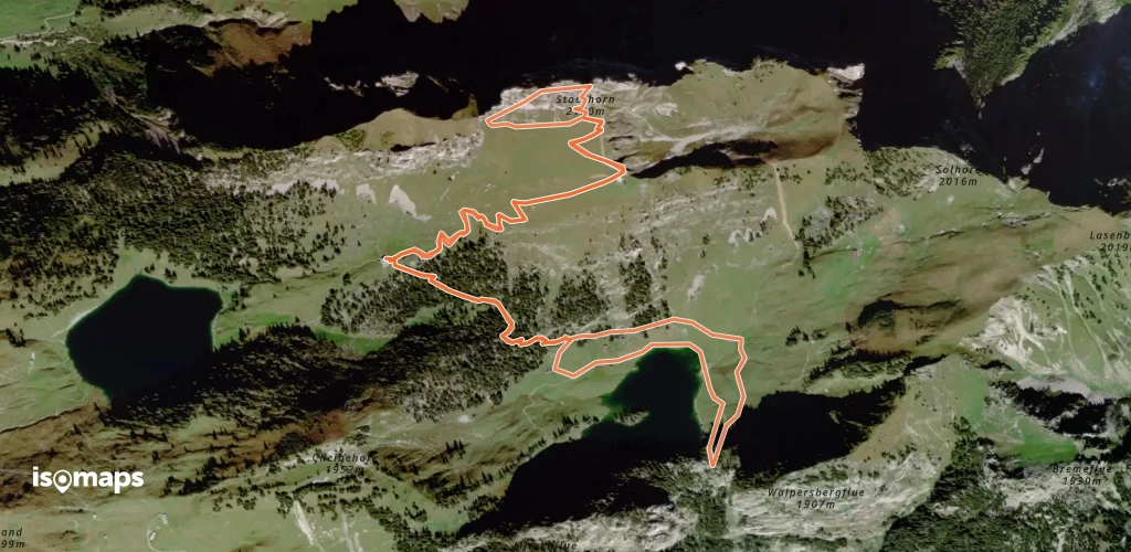
Stockhorn (Bern) - Arête W, voie "Chumm und lueg"

Stockhorn, Suisse

7,04 km +718 m 2h 20min

Moderate
Pfadflue - Salü Jan
Pfadflue - Salü Jan

Ober Sattel, Suisse

3,44 km +476 m 1h 0min

Moderate
Rüdigenspitze - La Marti

Bireflue, Switzerland

6,55 km +1 426 m 1h 55min

Moderate
Gastlosen - Les Pucelles - Traversée SW → NE

Les Pucelles, Switzerland

4,37 km +536 m 1h 25min

Moderate
Nüneneflue - Traversée NE - SW

Nüneneflue, Suisse

6,73 km +670 m 1h 35min

Moderate

Ready for your next adventure?

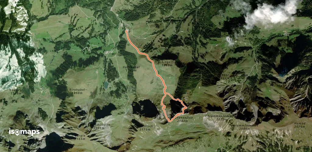
Try Isomaps free for 7 days. Available on iOS and Android.

Download on iOS Download on Android APK (Google-free)
Isomaps Your outdoor outings, anywhere, even offline
Install Install