Unstaffed hut · 1 520 m · Livet-et-Gavet
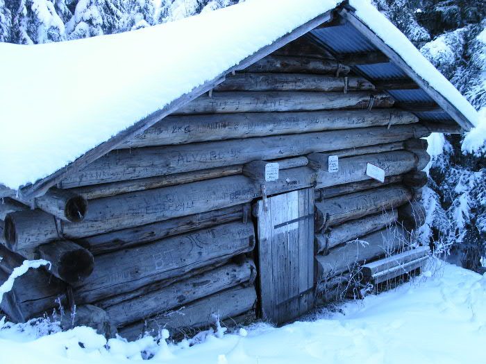
The Cabane de Queue de chien is an unguarded hut located in the commune of Livet-et-Gavet, in Isère. It is publicly owned.
Loading the forecast…
From the hamlet of Les Clos, altitude 700 m (commune of Livet-et-Gavet), a path that is not very well marked, quite steep, with a very forested atmosphere. Be careful: the path crosses several forest tracks and is not always easy to follow (this path is marked on the IGN map). From the parking lot at Lac du Poursollet (altitude 1650 m), pass by the chalets de la Barrière (altitude 1860 m) and descend 340 m in elevation (quite steep).
The shelter is marked on the IGN map. Coordinates read on carto-exploreur. Rudimentary shelter made of whole tree trunks, not insulated, gaps between the logs. Roof presumably watertight, earthen floor, no stove, a wooden lower bunk without a mattress, suitable for 2 or 3 people to sleep. The floor space is large enough to accommodate a group of about ten people. Very forested and wild atmosphere (not many people on this side). For water, there is the [->2365] 150 m away, but the water may not be drinkable; the chalets de la Barrière are upstream.
No source says whether this hut is open. Missing information is not a guarantee.
This page brings together several open sources. The licences below apply to their respective content.
Try Isomaps free for 7 days. Available on iOS and Android.


