Bayerischer Wald

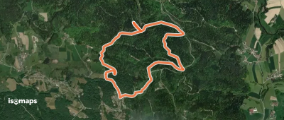
908 itinéraires dans Bayerischer Wald. Trouvez votre prochain parcours sur Isomaps — cartes topo, GPS et profil altimétrique.
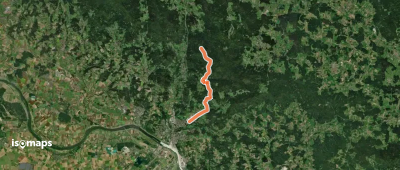
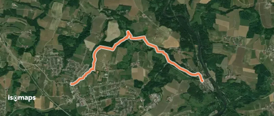
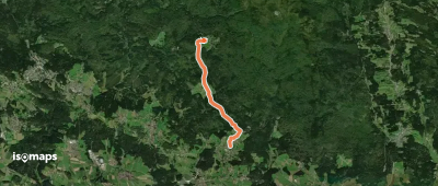
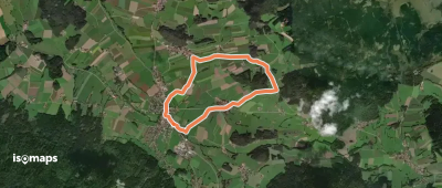
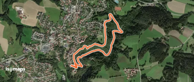
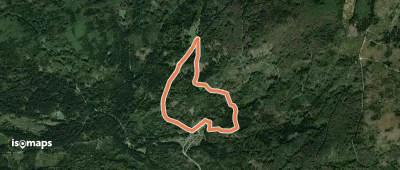
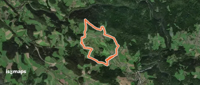
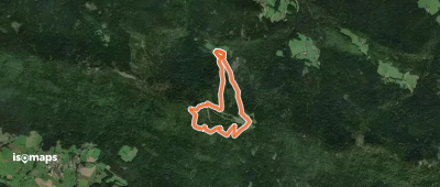
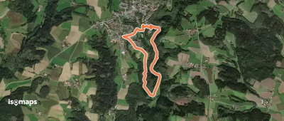
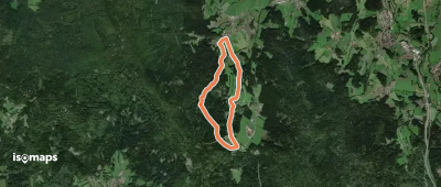
La1 Lam - Osser (Künischer Grenzweg)

Lam, Allemagne

13,56 km +1 575 m 4h 15min

Difficile
La5 Lam - Hoher Riegel - Tanneneck

Kronwithöhe, Allemagne

4,58 km +108 m 1h 5min

Très facile
Halser Ilzschleife
Halser Ilzschleife

Reut, Allemagne

4,85 km +158 m 1h 15min

Très facile
Wanderwege rund um Nittenau - 02 - Wackelstein

Marienthal, Allemagne

12,34 km +416 m 2h 55min

Facile
La3 Lam - Osser (Osser-Riesensteig)

Lam, Allemagne

5,22 km +651 m 1h 55min

Modéré
Nr. 29: Sonnenwaldrunde

Schöfweg, Allemagne

19,84 km +803 m 4h 50min

Modéré
Wanderweg 3
Wanderweg 3

Rattiszell, Allemagne

7,82 km +202 m 1h 45min

Très facile
Bienenlehrpfad
Bienenlehrpfad

Hetzenbach, Allemagne

3,58 km +141 m 50min

Très facile
Goldsteig Alternative Nr.33 a, Fürsteneck - Hinterschmiding

Fürsteneck, Allemagne

33,30 km +1 717 m 9h 20min

Très difficile
T 3 Otterbachtal - Aschenbrennermarter

Heuweg, Allemagne

4,47 km +28 m 55min

Très facile
Wanderweg 5

Ascha, Allemagne

9,21 km +291 m 2h 10min

Facile
Viechtach, Zielwanderweg 3 nach Gumpenried

Viechtach, Allemagne

12,25 km +467 m 3h 5min

Facile
Mühlen bei Röhrnbach

Röhrnbach, Allemagne

11,81 km +433 m 2h 50min

Facile
10 Bodenmais - Silberberg

Bodenmais, Allemagne

7,97 km +413 m 2h 5min

Facile
Wanderweg 6
Wanderweg 6

Mitterfels, Allemagne

11,15 km +360 m 2h 45min

Facile
Kirchen- & Kapellenweg (Marien-Runde)

Frauenau, Allemagne

5,90 km +175 m 1h 20min

Très facile
Zielwanderweg Drachselsried - Wiesing

Weigelsberg, Allemagne

3,62 km +231 m 1h 0min

Très facile
Graflinger Tal Rundwanderweg Nr. 2

Wühn, Allemagne

5,41 km +226 m 1h 25min

Très facile
Zielwanderweg 2 Arnbruck - Wiesing

Haselbach, Allemagne

5,23 km +266 m 1h 20min

Très facile

Prêt pour votre prochaine sortie ?

Essayez Iso Maps gratuitement pendant 7 jours. Disponible sur iOS et Android.

Télécharger sur iOS Télécharger sur Android APK (sans Google)