Bayern

4,193 itinéraires dans Bayern. Trouvez votre prochain parcours sur Isomaps — cartes topo, GPS et profil altimétrique.

Rehberg-Weg
Rehberg-Weg

Kulmbach, Allemagne

10,27 km +334 m 2h 35min

Facile
Rundwanderweg 3
Rundwanderweg 3

Neuenhammer, Allemagne

6,52 km +161 m 1h 30min

Très facile
Rundweg Viereth-Trunstadt V-T 4

Priesendorf, Allemagne

2,89 km +94 m 45min

Très facile
Rundwanderweg 3 Sparneck

Sparneck, Allemagne

5,38 km +188 m 1h 15min

Très facile
Contemplatio Neumarkt - Freystadt Etappe 1

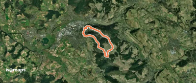
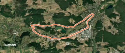
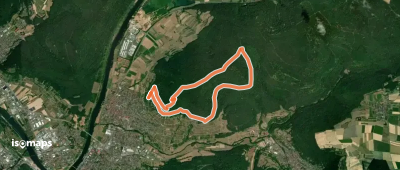
Neumarkt in der Oberpfalz, Allemagne

3,88 km +172 m 1h 0min

Très facile
Karlebachtal Runde
Karlebachtal Runde

Unteraltertheim, Allemagne

6,59 km +141 m 1h 25min

Très facile
Seebühler Rundweg
Seebühler Rundweg

Fäßleinsberg, Allemagne

9,01 km +92 m 1h 50min

Facile
26 Judenweg
26 Judenweg

Spalt, Allemagne

12,34 km +93 m 2h 30min

Facile
Wenzelberg Nord
Wenzelberg Nord

Hirschau, Allemagne

3,64 km +70 m 45min

Très facile
Lauftour EBL3

Ebelsbach, Allemagne

6,90 km +64 m 1h 25min

Très facile
IVV Rundweitwanderweg München Fünf-Seen-Land Etappe 2 Lochhausen-Planegg

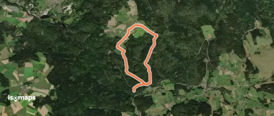
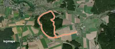
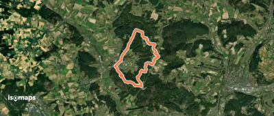
Aubing-Lochhausen-Langwied, Allemagne

7,26 km +88 m 1h 30min

Très facile
Heunischenburg-Weg HRW 9

Mitwitz, Allemagne

18,44 km +463 m 4h 20min

Modéré
Zum Schloss an der Paar

Paar, Allemagne

9,74 km +46 m 1h 55min

Facile
Kleeblattweg 1
Kleeblattweg 1

Lengenwang, Allemagne

7,76 km +111 m 1h 40min

Très facile
Wanderroute 2 (Marktleuthen)

Hebanz, Allemagne

4,29 km +83 m 55min

Très facile
Grenzwanderweg 6 km

Egglkofen, Allemagne

4,99 km +73 m 1h 0min

Très facile
Eichblatt
Eichblatt

Oberdachstetten, Allemagne

9,69 km +201 m 2h 5min

Facile
Blaupunkt
Blaupunkt

Kleinweismannsdorf, Allemagne

8,45 km +70 m 1h 45min

Facile
Rundwanderweg Bürgstadt Stutz 6: Wannenberg-Weg

Bürgstadt, Allemagne

8,17 km +320 m 2h 0min

Facile
Wasserschloss-Runde
Wasserschloss-Runde

Mitwitz, Allemagne

13,05 km +269 m 2h 50min

Facile

Prêt pour votre prochaine sortie ?

Essayez Iso Maps gratuitement pendant 7 jours. Disponible sur iOS et Android.

Télécharger sur iOS Télécharger sur Android APK (sans Google)