Bayern

4,193 itinéraires dans Bayern. Trouvez votre prochain parcours sur Isomaps — cartes topo, GPS et profil altimétrique.

Neualbenreuth: In einem Tag durch das Fraisch-Gebiet

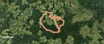
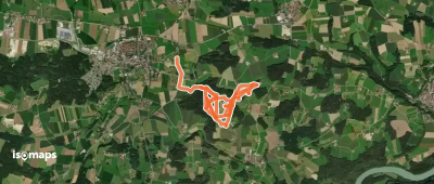
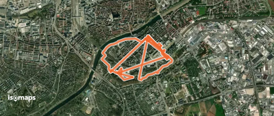
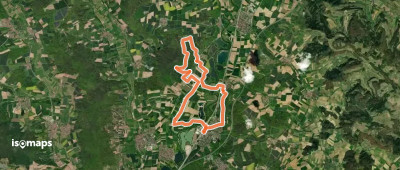
Bad Neualbenreuth, Allemagne

33,64 km +1 176 m 7h 30min

Très difficile
Rundwanderweg Specht Altershausen

Altershausen, Allemagne

5,52 km +129 m 1h 15min

Très facile
Georg-Wilhelm-Steller-Naturerlebnispfad

Bad Windsheim, Allemagne

2,78 km +27 m 35min

Très facile
Rundweg Aschhofen
Rundweg Aschhofen

Kleinhöhenrain, Allemagne

4,07 km +105 m 55min

Très facile
Weg des Steins
Weg des Steins

Kleinrinderfeld, Allemagne

9,06 km +131 m 1h 50min

Facile
Toteiskesselweg
Toteiskesselweg

Altdorf, Allemagne

6,18 km +167 m 1h 25min

Très facile
Redwitzer Runde
Redwitzer Runde

Redwitz an der Rodach, Allemagne

5,18 km +137 m 1h 10min

Très facile
Grünstrich
Grünstrich

Buchenbühl, Allemagne

16,95 km +95 m 3h 20min

Modéré
Südweg
Südweg

Neuenmarkt, Allemagne

74,28 km +2 012 m 16h 50min

Très difficile
Parkgeschichten
Parkgeschichten

Ulm, Allemagne

4,58 km +61 m 1h 0min

Très facile
Rund um Schloss Seehof

Memmelsdorf, Allemagne

11,69 km +139 m 2h 25min

Facile
Rote Raute bei Kalchreuth

Kalchreuth, Allemagne

3,29 km +45 m 40min

Très facile
Brotzeitweg

Berg bei Neumarkt in der Oberpfalz, Allemagne

9,45 km +164 m 1h 55min

Facile
Rundweg Großhöhenrain

Hub, Allemagne

3,26 km +62 m 40min

Très facile
Zapfendorf Rundwanderweg Schwarze 4

Zapfendorf, Allemagne

16,21 km +222 m 3h 25min

Modéré
Veni-Vidi-Vici Weg

Oberhambach, Allemagne

7,24 km +108 m 1h 30min

Très facile
3_Gipfel_Weg
3_Gipfel_Weg

Hirschau, Allemagne

12,65 km +325 m 2h 45min

Facile
Prienbach - Ering
Prienbach - Ering

Prienbach, Allemagne

10,64 km +84 m 2h 15min

Facile
Nord Süd Trail, Abschnitt Friedrichshafen - Weiler im Allgäu

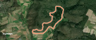
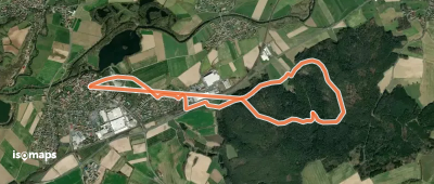
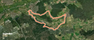
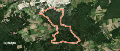
Kressbronn am Bodensee, Allemagne

52,61 km +1 106 m 11h 50min

Très difficile
B8
B8

Oberrimbach, Allemagne

13,45 km +285 m 2h 55min

Facile

Prêt pour votre prochaine sortie ?

Essayez Iso Maps gratuitement pendant 7 jours. Disponible sur iOS et Android.

Télécharger sur iOS Télécharger sur Android APK (sans Google)