Bayern

4,193 itinéraires dans Bayern. Trouvez votre prochain parcours sur Isomaps — cartes topo, GPS et profil altimétrique.

Rundwanderweg KopfeichenLand

Hetzles, Allemagne

10,10 km +640 m 2h 25min

Facile
Kuhnigundenweg
Kuhnigundenweg

Reute, Allemagne

4,63 km +167 m 1h 10min

Très facile
Neualbenreuth: Tillenweg

Bad Neualbenreuth, Allemagne

10,87 km +486 m 2h 35min

Facile
Lauftour ERM1
Lauftour ERM1

Ermershausen, Allemagne

10,67 km +201 m 2h 15min

Facile
Zehntgrafenweg Wipfeld

Schwanfeld, Allemagne

3,89 km +97 m 50min

Très facile
Kronstadter Boden

Rottendorf, Allemagne

12,05 km +252 m 2h 35min

Facile
Pinzberger Rundwanderweg

Pinzberg, Allemagne

13,63 km +348 m 3h 5min

Facile
Rothenburger W5 - Jakobsweg

Bettenfeld, Allemagne

17,90 km +449 m 4h 15min

Modéré
Landkreislauf Nürnberger Land 2011 Etappe 10

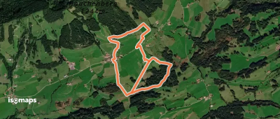
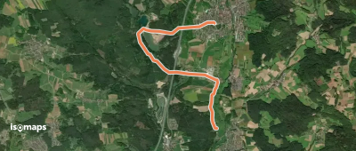
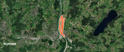
Schnaittach, Allemagne

6,59 km +76 m 1h 20min

Très facile
Rundwanderweg Wemding 2

Wemding, Allemagne

8,33 km +210 m 1h 50min

Facile
Rundweg Viereth-Trunstadt V-T 1

Roßstadt, Allemagne

5,25 km +127 m 1h 15min

Très facile
Reuther Kulturrunde
Reuther Kulturrunde

Röthenbach, Allemagne

9,93 km +159 m 2h 5min

Facile
Alter Herrgott Weg
Alter Herrgott Weg

Bad Neualbenreuth, Allemagne

6,19 km +207 m 1h 25min

Très facile
Kirchenqartett
Kirchenqartett

Rohrbach, Allemagne

9,43 km +151 m 2h 0min

Facile
Naturraum Hofau-Innleiten

Innleiten, Allemagne

7,36 km +163 m 1h 40min

Très facile
30 Kirschgartenwanderung

Spalt, Allemagne

6,36 km +97 m 1h 20min

Très facile
Vordorf Rundwanderweg Nr. 1

Bergwachthütte, Allemagne

9,79 km +188 m 2h 5min

Facile
Rundwanderweg Drei-Frankenstein-Weg Schlüsselfeld-Burghaslach-Geiselwind

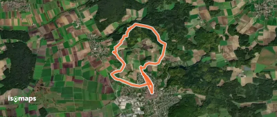
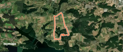
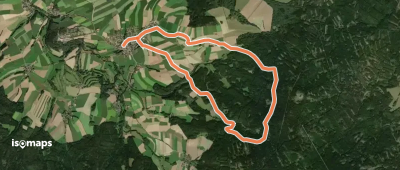
Schlüsselfeld, Allemagne

45,76 km +1 140 m 10h 15min

Très difficile
Bleierzweg
Bleierzweg

Freihungsand, Allemagne

16,48 km +166 m 3h 20min

Modéré
Rundwanderweg Schmetterling

Tennenlohe, Allemagne

9,24 km +75 m 1h 50min

Facile

Prêt pour votre prochaine sortie ?

Essayez Iso Maps gratuitement pendant 7 jours. Disponible sur iOS et Android.

Télécharger sur iOS Télécharger sur Android APK (sans Google)