Bayern

4,193 itinéraires dans Bayern. Trouvez votre prochain parcours sur Isomaps — cartes topo, GPS et profil altimétrique.

Tour 10 »Hennerlochtour«

Hirschling, Allemagne

4,68 km +178 m 1h 15min

Très facile
Speichersdorf Rundwanderweg Nr. 5

Vorbach, Allemagne

7,63 km +117 m 1h 35min

Très facile
Zum Bienenlehrpfad oberhalb Poing

Poing, Allemagne

4,21 km +69 m 55min

Très facile
Glaswanderweg Weidenberg - Warmensteinach - Fichtelberg - Bischofsgrün

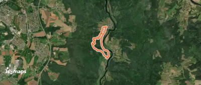
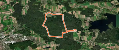
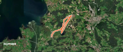
Warmensteinach, Allemagne

43,56 km +1 451 m 9h 55min

Très difficile
Weißmain-Ochsenkopf-Steig

Bischofsgrün, Allemagne

10,59 km +453 m 2h 45min

Facile
Pilgerweg 8
Pilgerweg 8

Rainding, Allemagne

2,24 km +85 m 30min

Très facile
Würmsee-Inntal-Weitwanderweg (weiß auf blau)

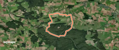
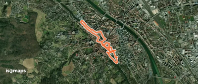
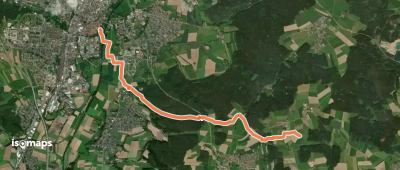
Starnberg, Allemagne

111,46 km +1 438 m 23h 25min

Très difficile
Nenzenheim Rundweg N1

Nenzenheim, Allemagne

12,96 km +282 m 2h 50min

Facile
Flusspfad
Flusspfad

Bamberg, Allemagne

3,79 km +35 m 50min

Très facile
Wanderweg 546 - Valley

Weyarn, Allemagne

4,47 km +25 m 1h 0min

Très facile
Puschendorf Wanderweg 3

Puschendorf, Allemagne

5,55 km +91 m 1h 10min

Très facile
Fränkisches Seenland 113

Frickenfelden, Allemagne

8,91 km +53 m 1h 45min

Facile
Goldsteig Zuweg Nr.6B Weiden → Muglhof

Weiden, Allemagne

7,28 km +288 m 1h 45min

Facile
Via Sancti Martini HW-34-x4 Ottobeuren - Tannheim

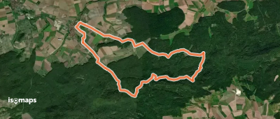
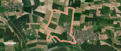
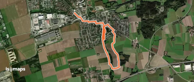
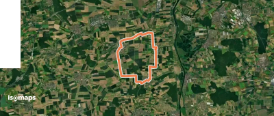
Ottobeuren, Allemagne

17,97 km +183 m 3h 40min

Modéré
Gefrees Rundwanderweg Nr. 2

Gefrees, Allemagne

6,39 km +190 m 1h 30min

Très facile
Zur Weidmeser Höhe KU 72

Weidmes, Allemagne

14,94 km +349 m 3h 20min

Facile
HK02 Zum Stallauer Weiher

Bad Heilbrunn, Allemagne

3,29 km +137 m 45min

Très facile
Waigolshäuser Rundweg - Oberes Werntal

Waigolshausen, Allemagne

12,05 km +132 m 2h 25min

Facile
Wanderweg 11 - Tüttensee

Grabenstätt, Allemagne

6,48 km +127 m 1h 20min

Très facile
Lauftour KÖN2
Lauftour KÖN2

Kottenbrunn, Allemagne

13,74 km +319 m 3h 20min

Facile

Prêt pour votre prochaine sortie ?

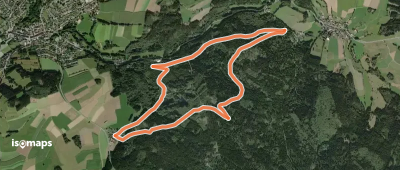
Essayez Iso Maps gratuitement pendant 7 jours. Disponible sur iOS et Android.

Télécharger sur iOS Télécharger sur Android APK (sans Google)