Nordrhein-Westfalen

6,248 itinéraires dans Nordrhein-Westfalen. Trouvez votre prochain parcours sur Isomaps — cartes topo, GPS et profil altimétrique.
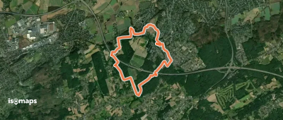
[Vollquadrat] Schwelm - Beyenburg

Schwelm, Allemagne

6,19 km +248 m 1h 50min

Facile
Hölterhof Rundweg A2

Ispingrade, Allemagne

9,20 km +327 m 2h 40min

Facile
Gahlen Rundweg A2
Gahlen Rundweg A2

Schermbeck, Allemagne

5,74 km +83 m 1h 10min

Très facile
A1, Extertal/ Rott
A1, Extertal/ Rott

Bremke, Allemagne

5,33 km +204 m 1h 25min

Très facile
Panoramaweg um den Gansberg

Rurberg, Allemagne

5,05 km +190 m 1h 25min

Très facile
<3> Bezirksrundweg 3 bei Olsberg

Olsberg, Allemagne

1,94 km +149 m 35min

Très facile
X5 Siegerlandweg
X5 Siegerlandweg

Iserlohn, Allemagne

118,11 km +5 028 m 32h 25min

Très difficile
Ölberg-Rundweg
Ölberg-Rundweg

Heisterbacherrott, Allemagne

2,44 km +138 m 45min

Très facile
Rundweg A7 Höhenweg Links der Volme (Dahl)

Dahl, Allemagne

7,34 km +385 m 2h 20min

Facile
Pader-Wanderung
Pader-Wanderung

Neuhaus, Allemagne

10,29 km +200 m 2h 20min

Facile
A5 Wisseler See

Kalkar, Allemagne

4,39 km +32 m 55min

Très facile
Rundweg A2
Rundweg A2

Strock, Allemagne

6,64 km +166 m 1h 30min

Très facile
Könenmühle Rundweg A3

Bechhausen, Allemagne

4,80 km +202 m 1h 35min

Facile
Freizeitbad Rundweg A1

Burscheid, Allemagne

3,34 km +105 m 45min

Très facile
X19 Schlösserweg [Wermelskirchen]

Oberhebbinghausen, Allemagne

5,58 km +154 m 1h 25min

Très facile
Kohlensiepen Rundweg H1

Witten, Allemagne

4,13 km +210 m 1h 20min

Très facile
Entenpfad nach Bruchhausen hohles Dreieck

Neheim, Allemagne

5,50 km +191 m 1h 20min

Très facile
Gahlen Rundweg A3
Gahlen Rundweg A3

Heisterkamp, Allemagne

4,42 km +55 m 55min

Très facile
Naturfreundeweg Bottrop - Ruhrtalhaus

Bedingrade, Allemagne

20,06 km +434 m 4h 30min

Difficile
(B) Rund um Bochum
(B) Rund um Bochum

Ückendorf, Allemagne

65,24 km +1 588 m 15h 10min

Très difficile

Prêt pour votre prochaine sortie ?

Essayez Iso Maps gratuitement pendant 7 jours. Disponible sur iOS et Android.

Télécharger sur iOS Télécharger sur Android APK (sans Google)