Alpes du Nord

8,548 itinéraires dans Alpes du Nord. Trouvez votre prochain parcours sur Isomaps — cartes topo, GPS et profil altimétrique.

Wanderweg WH
Wanderweg WH

Höfling, Autriche

10,85 km +507 m 3h 5min

Facile
Wanderweg 54
Wanderweg 54

Marbachhöhe, Autriche

3,51 km +34 m 1h 10min

Très facile
Schmieder Runde
Schmieder Runde

Schwoich, Autriche

4,27 km +94 m 1h 0min

Très facile
Weingarten-Tour
Weingarten-Tour

Eibiswald, Autriche

10,77 km +304 m 2h 40min

Facile
Wanderweg Lärchkogel

Lärchkogel, Autriche

8,37 km +56 m 3h 15min

Facile
Wanderweg 25
Wanderweg 25

Höf, Autriche

10,67 km +609 m 3h 35min

Modéré
Reith - Annakreuz
Reith - Annakreuz

Reith, Autriche

2,50 km +231 m 55min

Très facile
Wanderweg 4
Wanderweg 4

Andritz, Autriche

2,43 km +170 m 40min

Très facile
Kürbisrundwanderweg Preding Route C

Preding, Autriche

7,84 km +148 m 1h 40min

Très facile
Wanderweg 2 - Ellmau

Hartkaser, Autriche

8,06 km +42 m 2h 20min

Facile
Leiterlsteig
Leiterlsteig

Stollhof, Autriche

2,83 km +494 m 2h 30min

Facile
Wanderweg 252
Wanderweg 252

Pötschenstein, Autriche

4,96 km +85 m 1h 30min

Très facile
OSM Route 1593304
OSM Route 1593304

Rohr im Gebirge, Autriche

1,14 km +239 m 40min

Très facile
Wanderweg 4
Wanderweg 4

Rettenegg, Autriche

10,07 km +555 m 3h 5min

Modéré
Ritzmannsdorf-Tachenberg-Weg

Aigen im Ennstal, Autriche

3,81 km +166 m 1h 5min

Très facile
Wanderweg 25
Wanderweg 25

Judenburg, Autriche

5,59 km +295 m 1h 45min

Facile
OSM Route 15487420
OSM Route 15487420

Rangersdorf, Autriche

9,22 km +1 686 m 5h 5min

Très difficile
Weg des Buches - Etappe 1

Rosenthaler, Autriche

13,08 km +959 m 5h 10min

Difficile
42a
42a

Dörndl Aste, Autriche

2,15 km +303 m 1h 35min

Facile
Kaltenleutgeben - Rotes Kreuz - Hirschentanz e- Wiesenwirt

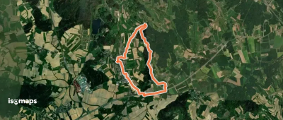
Breitenfurt bei Wien, Autriche

5,18 km +174 m 1h 25min

Très facile

Prêt pour votre prochaine sortie ?

Essayez Iso Maps gratuitement pendant 7 jours. Disponible sur iOS et Android.

Télécharger sur iOS Télécharger sur Android APK (sans Google)
Isomaps Vos sorties outdoor, partout, même sans réseau
Installer Installer