England

3,514 itinéraires dans England. Trouvez votre prochain parcours sur Isomaps — cartes topo, GPS et profil altimétrique.
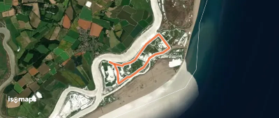
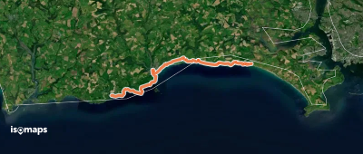
Green Trail, Orford Ness

Orford, Royaume-Uni

5,53 km +8 m 1h 5min

Très facile
Tatmore Hills Loop

Gosmore Hill, Royaume-Uni

6,71 km +76 m 1h 20min

Très facile
Via Beata
Via Beata

Ely, Royaume-Uni

115,42 km +666 m 23h 5min

Très difficile
Lakeside Amble, North Lakes Outdoors

Keswick, Royaume-Uni

4,32 km +65 m 55min

Très facile
Clay Way
Clay Way

Ridgmont, Royaume-Uni

17,91 km +148 m 3h 35min

Modéré
South West Coast Path (Section 33: Par to Polperro)

Par, Royaume-Uni

22,65 km +1 336 m 8h 40min

Très difficile
St James' Way
St James' Way

Southampton, Royaume-Uni

107,21 km +1 035 m 21h 50min

Très difficile
Cley Spy Circular Bird Walk

Saxlingham, Royaume-Uni

5,36 km +96 m 1h 5min

Très facile
Diss Circular Walk
Diss Circular Walk

Diss, Royaume-Uni

9,30 km +62 m 1h 50min

Facile
Orange Route, Hanbury Hall

Sharpway Gate, Royaume-Uni

3,16 km +70 m 40min

Très facile
Longster Trail
Longster Trail

Helsby, Royaume-Uni

19,01 km +185 m 3h 50min

Modéré
Great Hockham Yellow Walk

Stonebridge, Royaume-Uni

3,54 km +21 m 40min

Très facile
South West Coast Path (Section 34: Polperro to Portwrinkle)

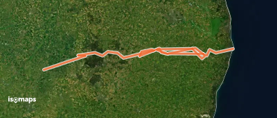
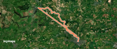
Polperro, Royaume-Uni

21,23 km +1 085 m 7h 35min

Très difficile
Milton Keynes Boundary Walk

Grafton Regis, Royaume-Uni

103,67 km +1 049 m 20h 55min

Très difficile
Red Trail, Orford Ness

Orford, Royaume-Uni

4,34 km +12 m 50min

Très facile
King Charles III England Coast Path: Marsland Mouth to Newquay

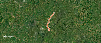
Newquay, Royaume-Uni

57,59 km +2 115 m 20h 30min

Très difficile
Murray Gray Trail (Saltwells LNR)

Netherton, Royaume-Uni

4,24 km +126 m 1h 0min

Très facile
Buckfastleigh to Totnes Trail

Totnes, Royaume-Uni

12,00 km +275 m 2h 55min

Facile
Greensand Ridge Walk

Leighton Buzzard, Royaume-Uni

72,27 km +928 m 14h 50min

Très difficile
View Point Walk
View Point Walk

Coton, Royaume-Uni

2,82 km +31 m 35min

Très facile

Prêt pour votre prochaine sortie ?

Essayez Iso Maps gratuitement pendant 7 jours. Disponible sur iOS et Android.

Télécharger sur iOS Télécharger sur Android APK (sans Google)