England

3,514 itinéraires dans England. Trouvez votre prochain parcours sur Isomaps — cartes topo, GPS et profil altimétrique.

Rail Trail: Wootton Wawen > Wilmcote

Wootton Wawen, Royaume-Uni

7,12 km +53 m 1h 25min

Très facile
Rail Trail: Berkswell Circular

Balsall Common, Royaume-Uni

6,55 km +73 m 1h 20min

Très facile
Sheffield Country Walk

Chapeltown, Royaume-Uni

88,81 km +2 066 m 20h 15min

Très difficile
Kingfisher Trail

Compton, Royaume-Uni

9,89 km +159 m 2h 0min

Facile
London LOOP (Section 24)

Rainham, Royaume-Uni

8,07 km +49 m 1h 40min

Facile
Effingham walk (SCC)

Effingham, Royaume-Uni

7,62 km +59 m 1h 30min

Très facile
Force Crag Mine Accessible Trail, North Lakes Outdoors

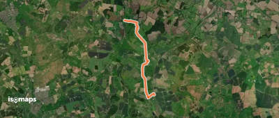
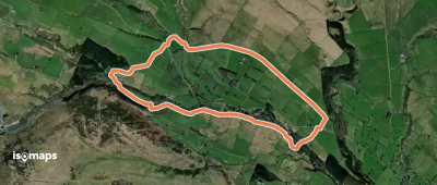
Grisedale Pike, Royaume-Uni

3,65 km +31 m 55min

Très facile
Jubilee Walkway (Western Loop)

London, Royaume-Uni

9,36 km +65 m 1h 55min

Facile
Rail Trail: Wilmcote > Wootton Wawen

Wilmcote, Royaume-Uni

8,66 km +66 m 1h 45min

Facile
Rail Trail: Hampton-in-Arden Circular

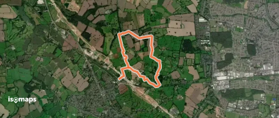
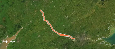
Hampton in Arden, Royaume-Uni

7,54 km +62 m 1h 30min

Très facile
In the Footsteps of Capability Brown, Ashridge Estate

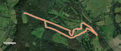
Aldbury, Royaume-Uni

6,25 km +62 m 1h 15min

Très facile
Kirklees Way
Kirklees Way

Skelmanthorpe, Royaume-Uni

122,05 km +3 420 m 28h 30min

Très difficile
The Wokingham Way
The Wokingham Way

Fobney Island, Royaume-Uni

88,03 km +764 m 17h 50min

Très difficile
High Force Geotrail
High Force Geotrail

The High Force, Royaume-Uni

5,43 km +120 m 1h 15min

Très facile
The Broomway
The Broomway

Samuel's Corner, Royaume-Uni

9,59 km +3 m 1h 55min

Facile
Tolkien Trail Cannock Chase Walk

Brocton, Royaume-Uni

17,03 km +328 m 3h 35min

Modéré
Mersey Valley Timberland Trail

Runcorn, Royaume-Uni

27,02 km +435 m 5h 40min

Difficile
Hillingdon Trail
Hillingdon Trail

Cranford, Royaume-Uni

29,89 km +330 m 6h 10min

Difficile
High Hunsley Circuit

North Newbald, Royaume-Uni

40,97 km +748 m 8h 35min

Très difficile
Shakespeare's Way
Shakespeare's Way

Clifford Chambers, Royaume-Uni

171,68 km +2 136 m 35h 25min

Très difficile

Prêt pour votre prochaine sortie ?

Essayez Iso Maps gratuitement pendant 7 jours. Disponible sur iOS et Android.

Télécharger sur iOS Télécharger sur Android APK (sans Google)