England

3,514 itinéraires dans England. Trouvez votre prochain parcours sur Isomaps — cartes topo, GPS et profil altimétrique.

ACW Circular Walk 17

Fillongley, Royaume-Uni

8,40 km +115 m 1h 40min

Facile
Mole Gap Trail
Mole Gap Trail

Dorking, Royaume-Uni

9,71 km +133 m 2h 5min

Facile
Round Aylesbury Walk

Haydon Hill, Royaume-Uni

21,10 km +136 m 4h 15min

Difficile
Tandridge Border Path

Merstham, Royaume-Uni

86,74 km +1 607 m 18h 25min

Très difficile
Two Bays Way
Two Bays Way

Brownsea Island, Royaume-Uni

36,09 km +633 m 8h 15min

Très difficile
Parkfield, Oakmere & Beyond 4 mile walk

Potters Bar, Royaume-Uni

6,60 km +84 m 1h 20min

Très facile
Smethwick Places of Worship Heritage Trail

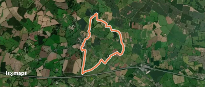
Smethwick, Royaume-Uni

6,86 km +71 m 1h 25min

Très facile
Rail Trail: Bearley > Claverdon

Bearley, Royaume-Uni

7,32 km +119 m 1h 30min

Très facile
Rail Trail: Birmingham International > Marston Green

Chelmsley Wood, Royaume-Uni

6,46 km +49 m 1h 20min

Très facile
ACW Circular Walk 17A (short-cut to C17)

Fillongley, Royaume-Uni

6,57 km +87 m 1h 20min

Très facile
Exe Valley Way
Exe Valley Way

Cove, Royaume-Uni

83,43 km +1 946 m 19h 30min

Très difficile
The Butcombe Trail

Banwell, Royaume-Uni

74,04 km +2 076 m 16h 25min

Très difficile
Woolhope Circular Walk

Woolhope, Royaume-Uni

9,66 km +159 m 2h 0min

Facile
Stone Circles Challenge

Stone Heath, Royaume-Uni

49,64 km +744 m 10h 10min

Très difficile
King Charles III England Coast Path: South Hayling to East Head

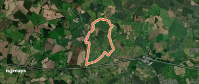
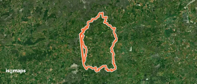
South Hayling, Royaume-Uni

77,06 km +294 m 15h 25min

Très difficile
Thames Path North Extension

Greenwich, Royaume-Uni

4,49 km +35 m 55min

Très facile
Woodland Walk at The Vyne

Sherborne St John, Royaume-Uni

3,24 km +29 m 40min

Très facile
St Frideswide’s Way
St Frideswide’s Way

Oxford, Royaume-Uni

66,60 km +272 m 13h 25min

Très difficile
Buckden To Kettlewell walk, Upper Wharfdale

Buckden, Royaume-Uni

7,13 km +52 m 1h 30min

Très facile
Studley Royal Deer Park Walk

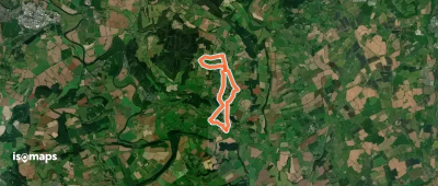
Lindrick with Studley Royal and Fountains, Royaume-Uni

4,34 km +75 m 55min

Très facile

Prêt pour votre prochaine sortie ?

Essayez Iso Maps gratuitement pendant 7 jours. Disponible sur iOS et Android.

Télécharger sur iOS Télécharger sur Android APK (sans Google)