England

3,514 itinéraires dans England. Trouvez votre prochain parcours sur Isomaps — cartes topo, GPS et profil altimétrique.

Colchester Orbital West A

Colchester, Royaume-Uni

7,16 km +72 m 1h 30min

Très facile
Three Peaks Walk
Three Peaks Walk

Ingleborough, Royaume-Uni

38,39 km +1 579 m 10h 20min

Très difficile
Millwood Trail (Long)

Grizedale, Royaume-Uni

2,25 km +83 m 35min

Très facile
Bogle Crag Trail (short)

Grizedale, Royaume-Uni

2,66 km +148 m 45min

Très facile
The Sculpture Trail, Hardwick

Stainsby, Royaume-Uni

4,70 km +196 m 1h 5min

Très facile
Barmpton & Little Ketton

Newton Ketton, Royaume-Uni

5,77 km +65 m 1h 10min

Très facile
Woodland Trail
Woodland Trail

Knettishall, Royaume-Uni

3,44 km +29 m 40min

Très facile
Broadhembury Circular Walk

North Hill, Royaume-Uni

7,10 km +195 m 1h 35min

Très facile
Stour Valley Path part 1

Stetchworth, Royaume-Uni

9,46 km +45 m 1h 50min

Facile
Wotton-under-Edge Cotswold Gateway Route 2

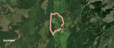
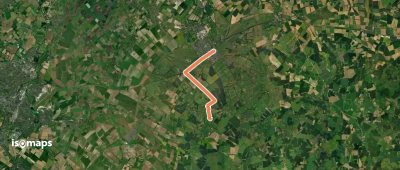
North Nibley, Royaume-Uni

6,97 km +184 m 1h 45min

Très facile
Hall Walk
Hall Walk

Fowey, Royaume-Uni

6,77 km +270 m 2h 15min

Facile
The Wray Castle to Latterbarrow Walk, Wray Castle

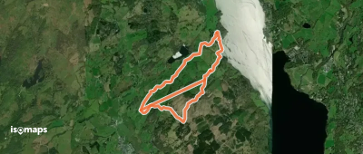
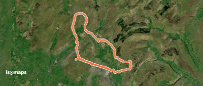
High Wray, Royaume-Uni

7,37 km +274 m 2h 0min

Très facile
Riverside Walk
Riverside Walk

Horsham, Royaume-Uni

20,84 km +215 m 4h 30min

Difficile
Capital Ring (Section 01)

Eltham, Royaume-Uni

10,00 km +127 m 2h 5min

Facile
Brafferton & Newton Ketton

Coatham Mundeville, Royaume-Uni

6,23 km +89 m 1h 15min

Très facile
Red Walk, Emmetts
Red Walk, Emmetts

Toy's Hill, Royaume-Uni

4,71 km +172 m 1h 10min

Très facile
Peak District Boundary Walk Stage 19

Bollington, Royaume-Uni

15,79 km +587 m 3h 55min

Modéré
South West Coast Path (Section 1: Minehead to Porlock Weir)

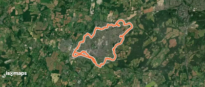
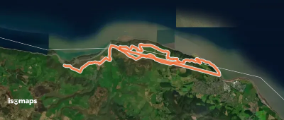
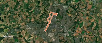
Porlock Weir, Royaume-Uni

20,24 km +889 m 6h 15min

Difficile
Taw Teign Link
Taw Teign Link

Chagford, Royaume-Uni

10,73 km +327 m 2h 35min

Facile
Capital Ring (Section 02)

Eltham, Royaume-Uni

5,85 km +49 m 1h 10min

Très facile

Prêt pour votre prochaine sortie ?

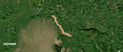
Essayez Iso Maps gratuitement pendant 7 jours. Disponible sur iOS et Android.

Télécharger sur iOS Télécharger sur Android APK (sans Google)