Bayern

4,193 itinéraires dans Bayern. Trouvez votre prochain parcours sur Isomaps — cartes topo, GPS et profil altimétrique.

Crescentia Pilgerweg

Ottobeuren, Allemagne

80,00 km +1 465 m 17h 15min

Très difficile
Lauter Raidelhütte (L 2)

Lauter, Allemagne

3,67 km +119 m 50min

Très facile
Teisendorfer Rundweg Nr. 1

Teisendorf, Allemagne

11,27 km +224 m 2h 30min

Facile
Pegnitz - Ebermannstadt

Ebermannstadt, Allemagne

66,07 km +2 019 m 16h 0min

Très difficile
Rundwanderweg Großostheim Reischklinge 2: Kapellen-Weg

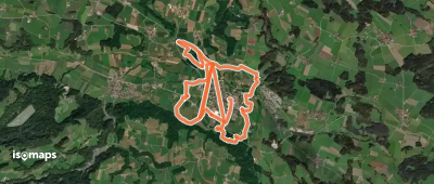
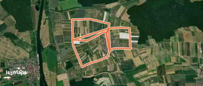
Großostheim, Allemagne

4,27 km +118 m 1h 0min

Très facile
Gössenheim, blaues Ia auf Gelb

Gössenheim, Allemagne

15,20 km +562 m 3h 40min

Modéré
Rundweg Eierberge
Rundweg Eierberge

Wiesen, Allemagne

3,41 km +189 m 1h 0min

Très facile
Landshuter Höhenwanderweg

Tiefenbach, Allemagne

48,78 km +1 295 m 11h 30min

Très difficile
Tour 16 blau
Tour 16 blau

Ellzee, Allemagne

3,67 km +31 m 45min

Très facile
Württ. Weinwanderweg (Aub - Mergentheim)

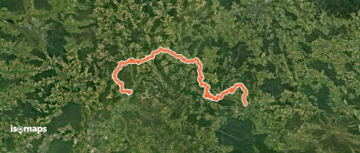
Bad Mergentheim, Allemagne

45,90 km +1 193 m 10h 30min

Très difficile
Fischlehrpfad
Fischlehrpfad

Haimpfarrich, Allemagne

13,05 km +122 m 2h 40min

Facile
Rundwanderweg Knetzgau K 6

Großer Knetzberg, Allemagne

2,96 km +31 m 35min

Très facile
Nordic Walking Bad Endorf Rot

Moosen, Allemagne

8,95 km +117 m 1h 50min

Facile
Ostbayerischer Jakobsweg (Eschlkam > Donauwörth)

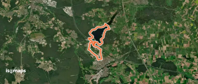
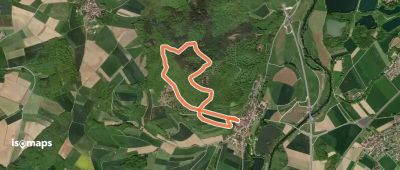
Donauwörth, Allemagne

277,74 km +6 161 m 61h 20min
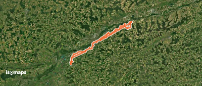
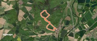
Très difficile
Andreas-Schettler-Weg/Christian-Woesch-Weg (Rotpunkt)

Altenfurt, Allemagne

23,31 km +479 m 5h 15min

Difficile
Fu61 (Daberger Rundweg)

Daberg, Allemagne

9,78 km +158 m 2h 0min

Facile
Höhenweg Eierberge
Höhenweg Eierberge

Wiesen, Allemagne

2,60 km +186 m 50min

Très facile
Lindacher Kreuzpfad
Lindacher Kreuzpfad

Lindach, Allemagne

6,03 km +111 m 1h 10min

Très facile
E1 Eschlkam-Gaishof-Eschlkam

Gaishof, Allemagne

4,62 km +47 m 55min

Très facile
Ruheberg Runde

Oberaltertheim, Allemagne

4,08 km +88 m 55min

Très facile

Prêt pour votre prochaine sortie ?

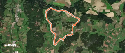
Essayez Iso Maps gratuitement pendant 7 jours. Disponible sur iOS et Android.

Télécharger sur iOS Télécharger sur Android APK (sans Google)