Nordrhein-Westfalen

6,248 itinéraires dans Nordrhein-Westfalen. Trouvez votre prochain parcours sur Isomaps — cartes topo, GPS et profil altimétrique.
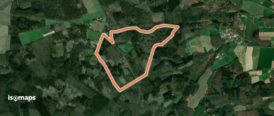
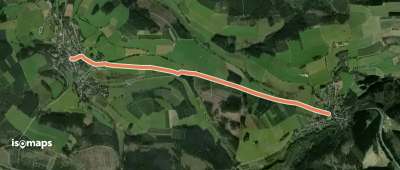
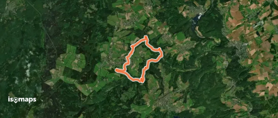
GrenzRouten: Naturerlebnispfad 2,4 km (Grün)

Vaals, Allemagne

2,45 km +195 m 1h 10min

Très facile
Granat Rundweg A6
Granat Rundweg A6

Granat, Allemagne

4,32 km +119 m 1h 0min

Très facile
Homertweg
Homertweg

Arnsberg, Allemagne

64,14 km +2 936 m 18h 35min

Très difficile
Altstadt Rundweg A2
Altstadt Rundweg A2

Monheim am Rhein, Allemagne

4,93 km +27 m 1h 0min

Très facile
Grafenschritte
Grafenschritte

Rietberg, Allemagne

5,92 km +56 m 1h 15min

Très facile
Winkel Grönebach - Küstelberg

Küstelberg, Allemagne

3,21 km +11 m 40min

Très facile
Rundwanderweg 35

Horn, Allemagne

10,82 km +475 m 3h 15min

Modéré
Rund um Wachtberg
Rund um Wachtberg

Meckenheim, Allemagne

38,47 km +822 m 8h 20min

Très difficile
Eifelschleife Hellenthaler Panorama

Hellenthal, Allemagne

3,04 km +210 m 1h 0min

Très facile
[I] HWW Westerwald Etappe 1 (Königswinter - Kölsch-Büllesbach)
[I] HWW Westerwald Etappe 1 (Königswinter - Kölsch-Büllesbach)

Königswinter, Allemagne

21,51 km +906 m 5h 25min
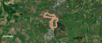
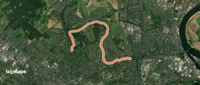
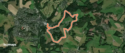
Difficile
[▶14] Königsforst-Thielenbruch
[▶14] Königsforst-Thielenbruch

Heide, Allemagne

15,78 km +334 m 3h 30min

Modéré
Rund um Wipperfürth W

Lamsfuß, Allemagne

48,40 km +1 699 m 12h 10min

Très difficile
[A2] Uffelnweg (Rummenohl)

Rummenohl, Allemagne

3,91 km +208 m 1h 10min

Très facile
Rundwanderweg Zurstraße - Benscheid

Zurstraße, Allemagne

4,87 km +192 m 1h 15min

Très facile
EifelSchleife Milchweg

Diefenbach, Allemagne

6,54 km +160 m 1h 30min

Très facile
Stadtwaldweg
Stadtwaldweg

Krefeld, Allemagne

6,30 km +103 m 1h 20min

Très facile
4 Täler
4 Täler

Vossenack, Allemagne

11,35 km +415 m 6h 30min

Facile
Ostwig Rundweg O5
Ostwig Rundweg O5

Bestwig, Allemagne

2,15 km +130 m 1h 40min

Très facile
GrenzRouten: Route 4 - Landgraben

Gemmenich, Allemagne

10,01 km +381 m 3h 5min

Facile
Much Rundweg A2
Much Rundweg A2

Much, Allemagne

4,49 km +193 m 1h 20min

Très facile

Prêt pour votre prochaine sortie ?

Essayez Iso Maps gratuitement pendant 7 jours. Disponible sur iOS et Android.

Télécharger sur iOS Télécharger sur Android APK (sans Google)