1,816 itinéraires dans Wallonie. Trouvez votre prochain parcours sur Isomaps — cartes topo, GPS et profil altimétrique.


Tellin, België / Belgique / Belgien
7,08 km +256 m 1h 45min
Très facile
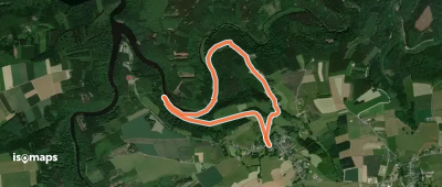
Petit Coo, België / Belgique / Belgien
4,74 km +189 m 1h 35min
Facile
Sougné-Remouchamps, België / Belgique / Belgien
5,22 km +127 m 1h 20min
Très facile


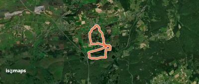
Tellin, België / Belgique / Belgien
12,59 km +375 m 2h 55min
Facile
Engreux, België / Belgique / Belgien
4,40 km +200 m 1h 10min
Très facile
La Penne, België / Belgique / Belgien
8,82 km +506 m 2h 5min
Facile


Essayez Iso Maps gratuitement pendant 7 jours. Disponible sur iOS et Android.
