Unstaffed hut · 2 275 m · Névache
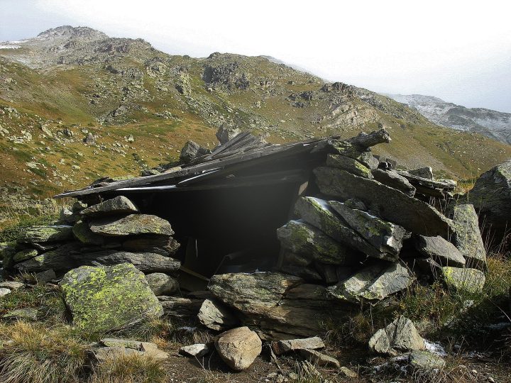
Unmaintained emergency shelter located in Névache, in the Hautes-Alpes. It is owned by an unknown party and reported as destroyed.
Loading the forecast…
From the Ricou refuge, take the path heading north along the GR57, but 100m below in elevation. The trail is marked on IGN maps. It is fairly easy to follow up to the marshy area at 2270m altitude. Then, navigate using the map. A good option is not to cross the Cula stream but to follow it upstream on its south bank to the 2275m contour, from where the shelter may be spotted.
"Cabin" as noted on IGN maps! Well... It is barely an emergency shelter with a wooden roof and a stone wall that may have seen better days long ago. It blends well into the landscape. It is marked on maps, but do not expect to find much. The roof appears fairly watertight, and by moving aside the old trough and the empty can, you might find a little space to shelter in bad weather, but that's all. Water is available nearby if you fetch it from the Cula stream. No comfort. The term "cabin" used by IGN is clearly misleading in this case.
This page brings together several open sources. The licences below apply to their respective content.
Try Isomaps free for 7 days. Available on iOS and Android.


