Staffed hut · 3 585 m · Gressoney-La-Trinité
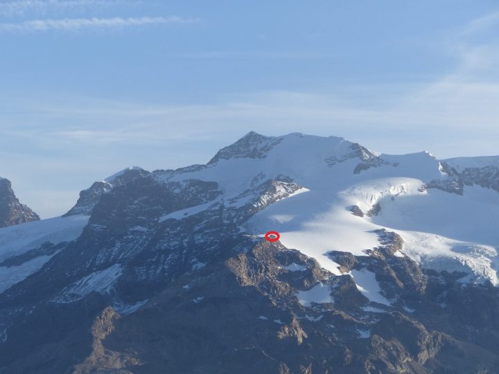
Guarded refuge located in the Valle d'Aosta, managed by the CAI Biella. Public property, it is situated in the municipality of Gressoney-La-Trinité.
Loading the forecast…
Maps: CNS (Switzerland) 1:50000, sheet 294 "Gressoney" Essential bibliography: the same as for [->1489] Apart from those coming from Switzerland via Col Felik (Felikjoch), or after crossing either the Castor or the Liskamm, essentially two starting points on the Valdôtain side, both converging at Col de Bettaforca: - either from St Jacques in Val d'Ayas, via the Résy alpine pastures and the Forca valley, - or from Stafal in the Gressoney valley (on this side, a chairlift operates in season and saves about 2h30). From Col de Bettaforca (2700 m approx.), head north and follow the eastern flank of the ridge rising above the pass, via scree terraces and a few rocks. You reach about 3100 m at the "upper Col de Bettolina", a vague saddle where the serious climbing begins; the ridge turns into a rocky crest, generally followed slightly to the right (east) or along the crest, with some rollercoaster-like sections. Some sections are equipped with cables; rocks are generally good as loose holds are eliminated by repeated climbers' passages. Exposed route. If snow and ice cover the terrain, some belays will be hidden and the ascent will require CRAMPONS (this was the case in June 1986...). A final steep step leads to the terrace where the new and old refuges are located. Allow a minimum of 6 hours for the "full" route (without the chairlift), regardless of the starting point.
The old refuge serves as a winter refuge (always open, 30 places) or as additional accommodation in case of overcrowding.
No source says whether this hut is open. Missing information is not a guarantee.
This page brings together several open sources. The licences below apply to their respective content.
Try Isomaps free for 7 days. Available on iOS and Android.


